Adress field
 The geolocation field of Flexicontent is an advanced technology that allows for the collection, storage, analysis, and display of geographic information within a flexible and customizable content management system (CMS). This geolocation field provides powerful features for integrating geographic data into a website or application.
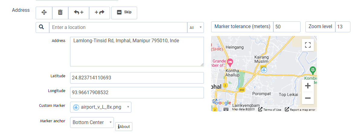
The geolocation field in Flexicontent enables the creation of custom geographic objects, such as points of interest, geographic areas, routes, etc. Each object can be associated with specific attributes, such as geographic coordinates, addresses, images, descriptions, etc.
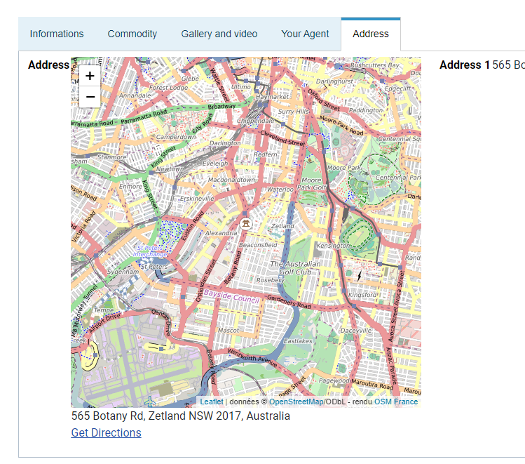
The advanced search features of Flexicontent allow for searching for geographic objects based on criteria such as distance, category, keywords, etc. The results can be displayed on an interactive map with markers, clusters, info windows, and other visualization elements to provide a rich and interactive user experience.
Flexicontent's geolocation field also offers the ability to manage categories of places, define custom icons for markers, use different coordinate systems, restrict access to geographic objects based on user permissions, manage routes with waypoints and directions, and much more.
The user-friendly administration interface of Flexicontent makes it easy to manage geographic objects, modify their attributes, import and export geographic data, and configure search and display settings according to the specific needs of the website or application.


Some examples of how the geolocation field of Flexicontent can be used:
-
Directory of Nearby Businesses: A website or application that showcases local businesses, such as restaurants, hotels, or stores, can use the geolocation field to collect and display business listings based on their geographic coordinates. Users can then search for nearby businesses based on their current location, view them on a map, and access additional information such as contact details, reviews, and ratings.
-
Real Estate Listings: A real estate website can use the geolocation field to associate properties with their precise geographic location, allowing users to search for available properties based on their desired location, price range, and other criteria. The properties can be displayed on a map, and users can click on markers to view property details, images, and contact information.
-
Travel and Tourism Guides: A travel website or application can use the geolocation field to create a database of tourist attractions, landmarks, or points of interest, and display them on a map for users to explore. Users can search for attractions in a specific area, view details, ratings, and reviews, and plan their itinerary accordingly.
-
Event Locator: An event management platform can use the geolocation field to allow event organizers to specify the location of their events, and users can search for events happening in their area or in a specific location. Users can view event details, RSVP, and get directions to the event venue using the map interface.
-
Job Listings: A job portal can use the geolocation field to allow employers to specify the location of job openings, and job seekers can search for job opportunities based on their location or desired work location. Users can view job details, apply for positions, and get directions to the workplace using the map functionality.
-
Social Networking: A social networking platform can use the geolocation field to enable users to share their location, check-in at places, and discover nearby friends or points of interest. Users can view the location-based posts of their connections, explore nearby places, and interact with others based on their geographic proximity.
These are just a few examples of how the geolocation field of Flexicontent can be utilized to enhance various types of websites or applications with powerful and interactive geographic functionalities. The flexibility and customization options offered by Flexicontent allow for versatile and tailored use cases depending on specific requirements.

